
The Mapping of Pomponius Mela’s Chorographia
Written by Caitlin Shanahan
When I began my PACE unit at Macquarie University this semester, we were provided a diverse range of internship options, there were so many opportunities to engage with cultural heritage and public history in a way that I had not considered up until this point in my studies. It was, however, hard to look past the intrigue of MANTO and the opportunity to partake in a creative and digital form of Greek Mythology. The project certainly challenged me from the start, from defining the ontology of MANTO to understanding the world of Linked Open Data, I was constantly broadened to new realms of history and how it can operate in the digital world. We began data collection for Pomponius Mela’s Chorographia and whilst it took a while to get the hang of it, slowly it became like clockwork, and I found myself gaining a new appreciation for mythology and its geographical origins.
Alongside our internship, our PACE unit at Macquarie also asked us to produce a ‘placement project,’ a creative piece of work that demonstrated what we had undertaken in the last 12 weeks of our internship and its wider contribution to public history and cultural heritage. I grappled with what I wanted to produce; I had an idea of creating a visual representation of the data we had collected from Pomponius Mela’s Chorographia. In doing this, I would also be challenging myself both creatively and digitally. I approached Greta with an idea of what I wanted to create, but with no clear answers of where I could look for such a tool. After some brainstorming, she suggested the possibility of using Recogito, an online platform for documentation annotation and mapping. Part of me wanting to do this for my project was also to enhance my understanding of Linked Open Data; Recogito is part of the Pelagios network – as are MANTO and Nodegoat – which aims to combine LOD and cultural heritage, hence being able to see importance of what we do in MANTO.
Greta was able to convert all the places and landmarks we entered from Pomponius Mela into a CSV document, the ‘machine readability’ significance of MANTO became apparent to me here as when I uploaded the document into Recogito, it allowed for an automatic matching of Pleiades ID and was able to place these on the map.
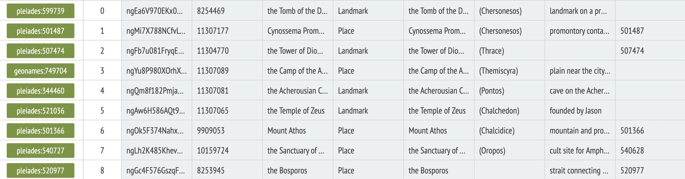
A screenshot of the CSV document uploaded to Recogito, showing the automatic matching using Pleiades ID

The mythical places and landmarks in Pomponius Mela mapped. You can access this map in Recogito here.
Greta also suggested to me that mapping all the cities and territories in Chorographia, regardless of mythological associations, may be interesting. This way a comparison of the two would show where in the ancient world has rich mythical narratives to tell. This map was a little more difficult to navigate and there were certainly limits to what I could achieve. For one, some places as described by Pomponius are simply unlocatable, MANTO usually comprises in these situations by adding “near” when a specific location for an entity is unknown. As this was not possible in Recogito, it was just a process mapping that location in its larger region described by Pomponius, or simply cutting my loses and moving ahead with the text.

All locations in Pomponius Mela mapped. You can access this map in Recogito here.
An even larger limitation to acknowledge, not just for this project but I suppose of any mapping of ancient texts is that we are generally not working within the same geographical understanding as their authors. When Pomponius Mela set out to explain the known world, it was a very different picture to what versions of the ancient world we have created. So in a sense, these maps we create are a ‘lie’ but I would argue they still have extreme importance in how we see Greek myth and its geographical boundaries int the ancient world.

Reconstruction of Pomponius Mela’s Map by Konrad Miller, 1898
I thoroughly enjoyed this project, mapping the data we had collected from Pomponius Mela using Recogito enhanced my understanding of Linked Open Data and its contribution to online public history. This project challenged me creatively, but I gained a new affection for the ancient world and how Greek mythology shaped its identity. I would like to thank Greta not just for her input on this project but for the last 12 weeks she has dedicated to this internship and sharing her passion.
The maps that I have created for this project can be accessed in Recogito: Mythical places and landmarks in Pomponius Mela is here; and all locations in Pomponius Mela is here.
This is the fourth in a series of blog posts from students at Macquarie University who answered the call for PACE interns this semester